Rozendaal forest
- Owner: Staatsbosbeheer
- Location: Municipality of Rozendaal
- Size: 90 ha reference site (total 289 ha)
- Soil: Hollow loam soils
Visiting this demonstration forest?
The Rozendaal forest is freely accessible to visitors. The forest is best reached by car, but can also be reached by bus from the Rozendaal bus stop, Kerklaan. By car, you can park at the Wageningen gate car park.
Do you have any questions about managing or visiting this reference site? Then please contact us via veluwe@staatsbosbeheer.nl.
Learning forest Rozendaal forest
The Rozendaal Forest is one of the three learning forestries managed by the Forestry Commission. Within the learning forests, students, teachers and researchers from Yuverta, Van Hall Larenstein University of Applied Sciences and Wageningen University are given the space to carry out practical education, research and graduation assignments. Because of its function as a learning forestry, the principles of LIFE Climate Forest and their translation into the conducted forest management immediately find their way towards education.
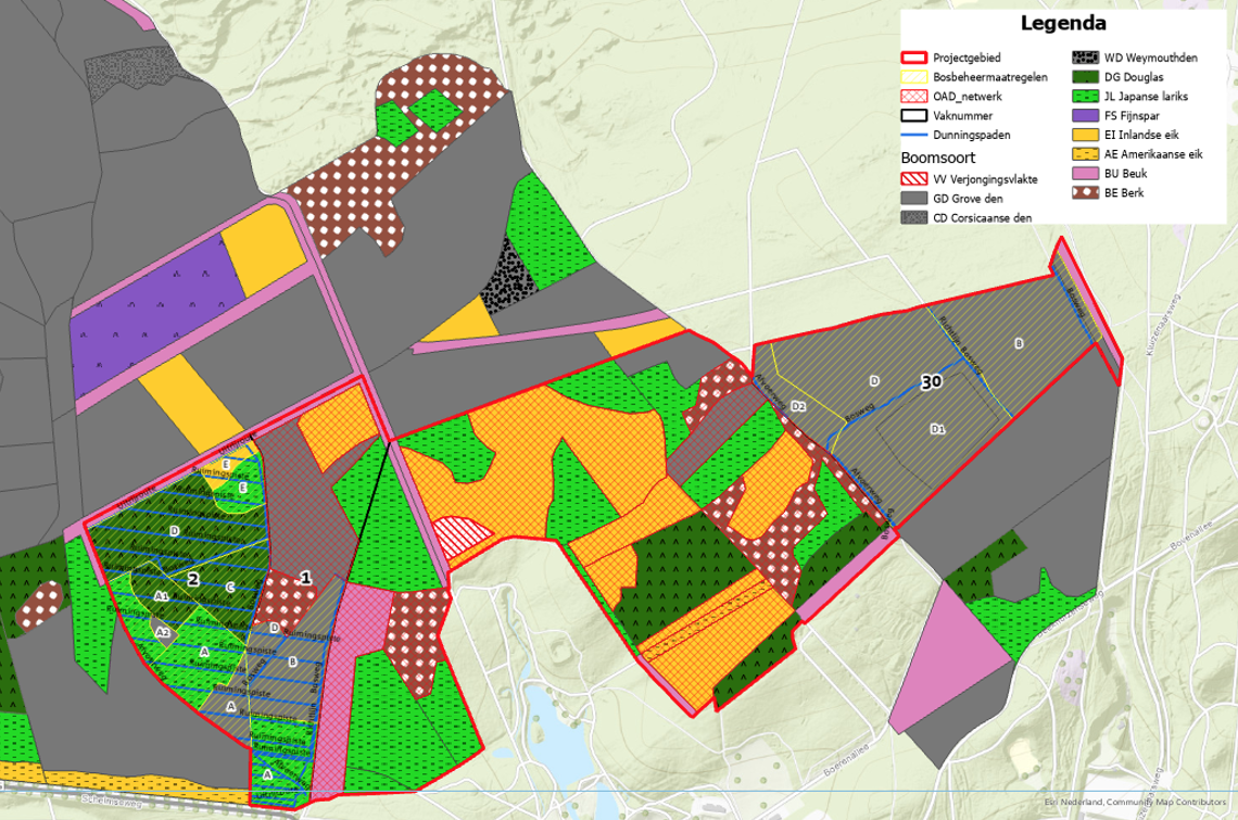
Within the exemplary forest (blue framed area on the map), three sub-areas can be distinguished from west to east:
- The western part has a somewhat richer soil and consists of stands of Douglas fir, Japanese larch and Scots pine. There, we have been working towards a clear-cut forest with a richer tree species composition in which selective felling takes place.
- The central section belongs to the oldest parts of the former estate, the first construction here dates from before 1800. In addition to groves of pine, larch, etc., this section also contains quite a lot of deciduous forest (former oak coppice) and a lane structure is present. This section is largely designated as qualifying habitat type "beech oak woodland with holly" and forms the basis for the network of Old, Decaying and Dead Trees (OAD). This is an important part of a forest's biodiversity.
- The eastern part concerns a poorer growth area and here there is relatively recent heathland afforestation with Scots pine. Relatively little structure and mixing is still present in this part.
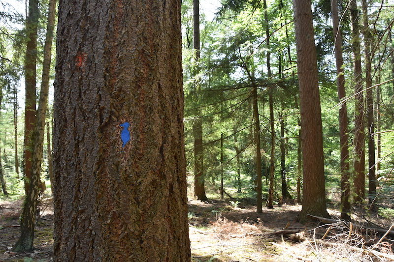
The habitat trees are marked with a ''blue woodpecker'.
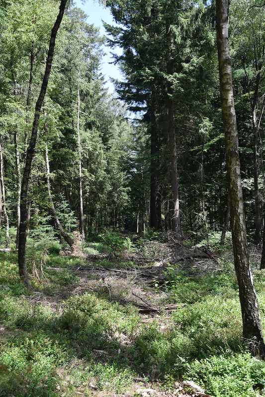
In the western part of the sample forest, the thinning paths are 40 m apart.
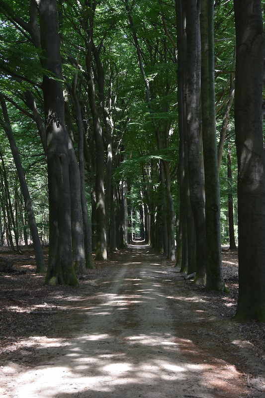
The beech avenues present are an important skeleton for the network of old, decaying and dead trees (OAD).
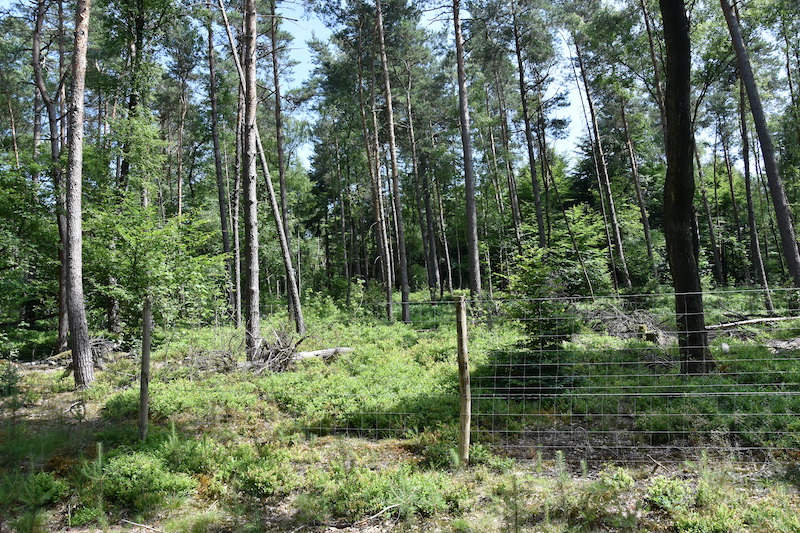
In the eastern part, the soil is poor and dry. Here, a grid ensures that hardwood rejuvenation can develop undisturbed.
Measures
To get a good picture of the forest, it is important to know what is there and how the forest functions. To achieve this, the western and eastern parts of the forest were mapped using forest tracking. This means walking through the forest in a targeted way, assessing the forest at tree level and recording it via GPS. The following measures were carried out:
- Thinning paths Construction: in the western and central part, the thinning paths for (future) timber harvesting had already been constructed and digitally recorded. The centre-to-centre distance depends on the stand and is either 20 m or 40 m. In the eastern part, the thinning paths were constructed and digitally recorded. In doing so, by using the elevation map, the location of existing thinning paths from previous harvesting rounds was first mapped.
- Using the qualifying habitat forest in the central part as a basis, the OAD network of with individual trees and groups of trees extended to the western and eastern parts of the Rozendaal forest.
- It bleached with the methodology of the bostracken. This involved identifying all future trees, veteran trees, habitat trees, amenity trees, options and quality trees in both canopy and rejuvenation. The exact location of these trees was recorded using a highly accurate GPS. Where applicable, trees were pruned immediately. Trees to be felled were then marked with orange paint.
The habitat, experience, and veteran trees are marked with a blue or green woodpecker applied using a template.
- The field also determined and recorded what promising planting spots are for planting small groups (clumps) with mixed tree species. Where necessary, undergrowth has been marked for removal at these sites.
- In autumn 2024, the timber harvest implemented in the western part. Harvesting in the eastern section is scheduled for 2026.
- In the autumn of 2025, the western section will see the planting carried out at designated planting sites. A group of students from the van Hall Larenstein University of Applied Sciences contributed ideas on this and worked out a plan incl. the monitoring design.
Due to the adjacent qualifying habitat forest, not all tree species could be applied. The following tree species were eventually chosen: silver fir, hornbeam, sessile oak, sweet cherry, winter lime, hawthorn and dirt tree. It is planned that these plantings will be followed over time from the course.
