Boswachterij Hardenberg
- Owner: Staatsbosbeheer
- Administrator: Staatsbosbeheer
- Location: Municipality of Hardenberg (Overijssel)
- Size: approx. 35 ha
- Soil: Field podzol Hn52
Visiting this demonstration forest?
Forestry Hardenberg is freely accessible to visitors.

Boswachterij Hardenberg
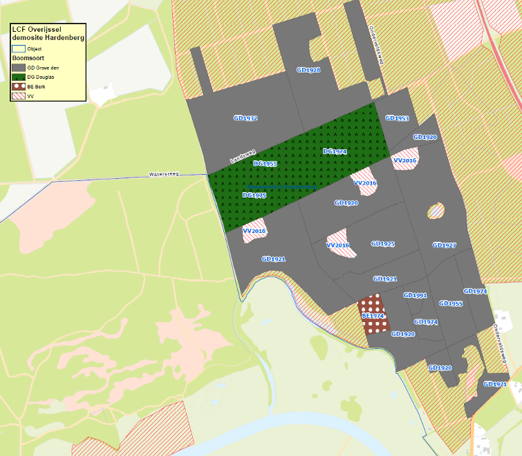
Boswachterij (forestry) Hardenberg is a first-generation Scots pine forest on former heathland. The demo site consists mostly of Scots pine (Pinus sylvestris), followed by Japanese larch (Larix kaempferi) and Douglas fir (Pseudotsuga menziesii). Furthermore, about 5% of the area consists of rejuvenation plains. The total area is 35.20 hectares. Forestry Hardenberg is mainly managed as a multifunctional forest with a focus on nature, production and recreation.
In this forest, we focus on the quality and vitality of individual trees and intervene locally. We focus on mixing species and ages and we want to ensure that wood production, recreation and biodiversity have a joint place within the forest system.
According to the Soil Map of the Netherlands, the soils in the demosite consist of level and field soils with loamy and weak loamy fine sand Hn52 with GT VI and VII and small parts of drifting sand and parts with marshy influences (GT V* and III*); Hn52 in moderately fine, loamy and weak loamy sand.
Measures
- To avoid unnecessarily traversing and thus compacting soil surfaces, it is important to insight into all thinning paths making. Therefore, during this step, all thinning paths and also driving routes were mapped. The thinning paths were also marked in the field.
- The current network of Old, Decaying and Dead trees (OAD) will be further expanded by designating habitat trees and nature islands. Within future management, the OAD network should be expanded, in the current situation the proportion is too low.
- A forest tracking took place (on ± 35.20 ha) with a specific focus on selecting vital and quality tree species from the 2nd tree layer. Forest tracing consists of the following 6 steps:
- Mark thinning paths;
- designation of habitat trees and tree groups;
- designation of future trees;
- Check and/or mark optional future trees (in the 2nd tree layer or shrub layer) (as an option);
- mapping rejuvenation sites;
- designate the trees to be harvested.
- Some of the quality trees/future trees/QD trees will, if necessary, be pruned and/or guided pruning takes place.
- During forest tracking, extra attention is paid to promising rejuvenation spots. At these locations, the following options were chosen from:
- Group felling/screen cutting for natural rejuvenation and/or replanting (up to max 0.5 hectare).
- Lowering ground plane (or thinning).
- Underplant if sufficient light is present.
At the promising rejuvenation sites, we assess soil, competition natural rejuvenation/rubbish and light availability. - We plant a selection of climate-resilient tree species (both different provenances, and non-native species). The composition of these species to be planted has not been determined at this time (March 2025).


